
*Edit – Tornado warning near Ottawa appears to have ended.
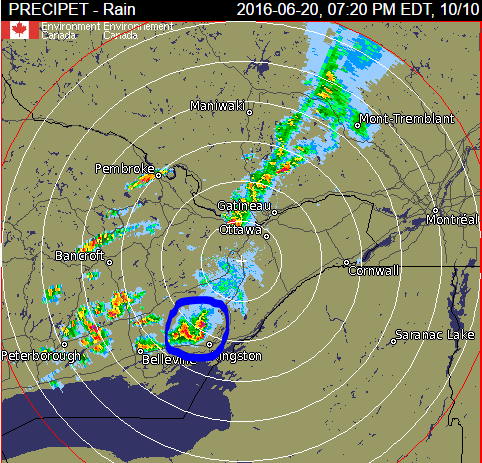
*Edit – Tornado warning near Ottawa looks like a smaller threat and should stay north of the city but hit the east end into Orleans -Cumberland area* Some very strong storms around the Belleville area with Tornado warnings. This cell below I circled in blue has tornado warnings and signature bow echos on the radar:
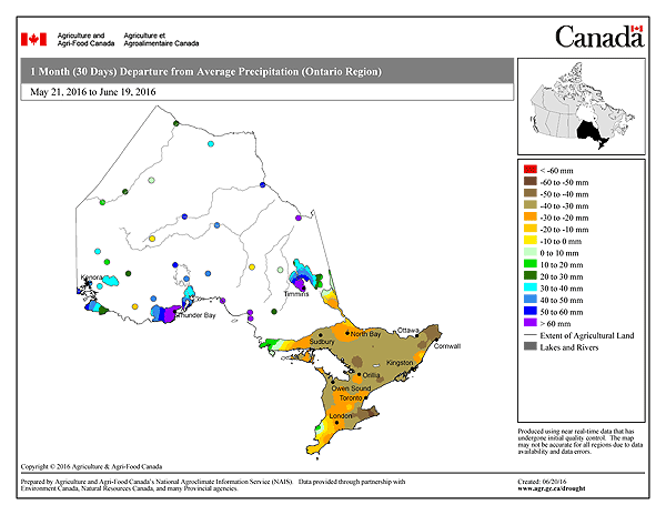
The lines breaks up around my area and redevelops north of Ottawa and in Quebec. It would have been nice to get the rain but certainly not a deadly storm. My grass is once again back to mid-summer deadness. I don’t think I can recall a spring were I have mowed the grass so little, as evident by the below graph for our below normal rainfall to date:
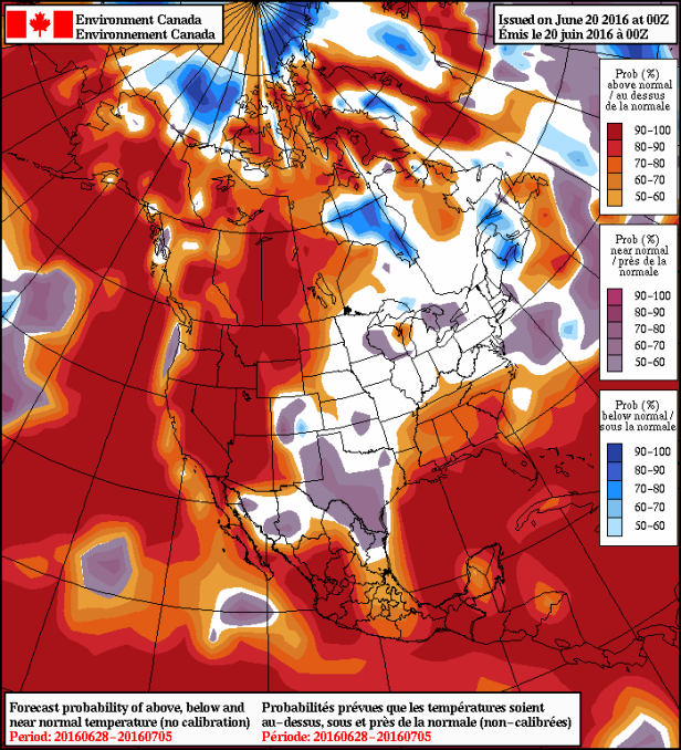
Tonight’s potential storms are a courtesy of another low pressure system sweeping through, that then sits over Northern Quebec for a couple days and spreads cool Northwest winds. The goods news; this time the northwest flow wont be as strong and cold or as long lasting, so temperatures will only be 3 – 5 degrees colder on Tuesday – Wednesday (colder is a relative term this time of year, as the normal is 25c). Things should warm up again by Thursday – Friday and back to near 30c by the weekend. Also again Eastern ON and Quebec will feel the brunt of the Northwest flow compared to Southern ON which should remain relatively near normal.
After the warmth next weekend it appears we are back to normal temperatures through the first week of July, meaning 24c – 27c.
Also dry once again, with only a day or two with a chance of showers over the next 15 days. Good news for those planning vacation and outdoor activities, bad news if you like green grass and growing crops. Enjoy the nice weather, it’s what we were dreaming about back in January 🙂
