
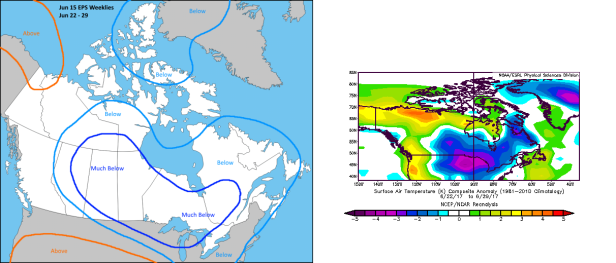
Brief verification of the run from the 15th of June which highlighted the timeframe from the 22nd to the 29th.
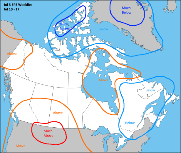
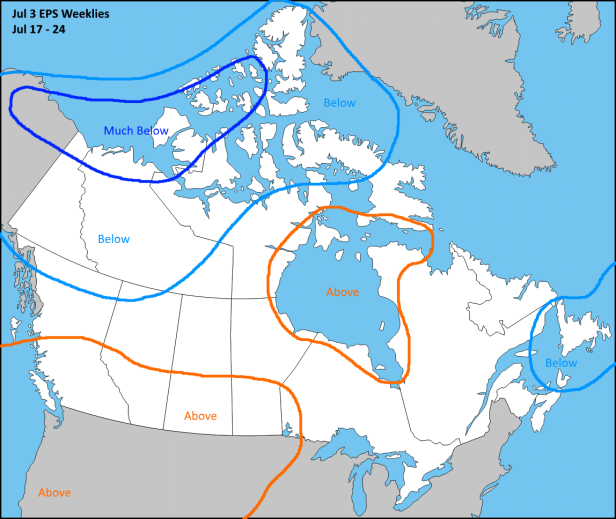
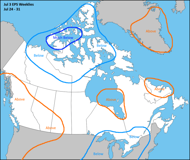
New data now taking us straight through the end of July.
Next run will be the evening of Thursday July 6th.
Brief verification of the run from the 15th of June which highlighted the timeframe from the 22nd to the 29th.
New data now taking us straight through the end of July.
Next run will be the evening of Thursday July 6th.
All the Weather All the Time!
Covering weather and climate in New Brunswick, Canada and beyond... (Data courtesy ECCC)
Weather forecasts and discussions for Canada
a service of Advantage Weather Solutions
The world's most viewed site on global warming and climate change
Information about severe weather in southern Quebec and eastern Ontario
Weather forecasts and discussions for Canada
A daily selection of the best content published on WordPress, collected for you by humans who love to read.
The Art and Craft of Blogging
The latest news on WordPress.com and the WordPress community.

The 12Z ECMWF OP has H85 temps falling close to or below 0 C in our areas on day 6.
LikeLike
FROPA directly preceding that is somewhat moisture-starved this run but the high & low temps (F) for that period at YUL are as follows.
Jul 10th – 64/59
Jul 11th – 66/52
Jul 12th – 71/54
Jul 13th – 77/56
This is the deterministic 12z as the ensembles are still updating.
LikeLike
The same outlook via the 12z EPS.
Jul 10th – 70/58
Jul 11th – 74/57
Jul 12th – 77/59
Jul 13th – 77/62
LikeLike
I wonder will we ever see the ABOVE NORMAL over Ontario or Quebec? I feel like this zone has had constant below normal the past few months. I guess this is payback for the extreme heat of summer 2016?
Looks like the Prairies are in for an awesome summer though. Calgary could break its record for the most 30C ever recorded if this pattern holds (record is 13 in 2003).
LikeLike
Most of YYC’s daily record highs are in the 32-35c range over the next few days so they may be able to give some of them a run for the money as well.
LikeLike